1.1 The Taming of the Central Asian Rivers
The conquest of nature, as per the thinking of the tsarist Russian government in the late 19th century, was an essential precondition of successful colonial policy. It enabled the economic appropriation of new territories and facilitated the development of administration and the integration of local authorities into the colonial system (Pravilova 2009).
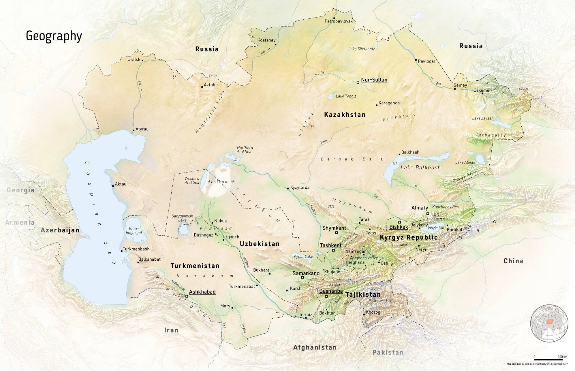
Figure 1.1: Geography of the Central Asia Region. Source: Zoï Environment Network.
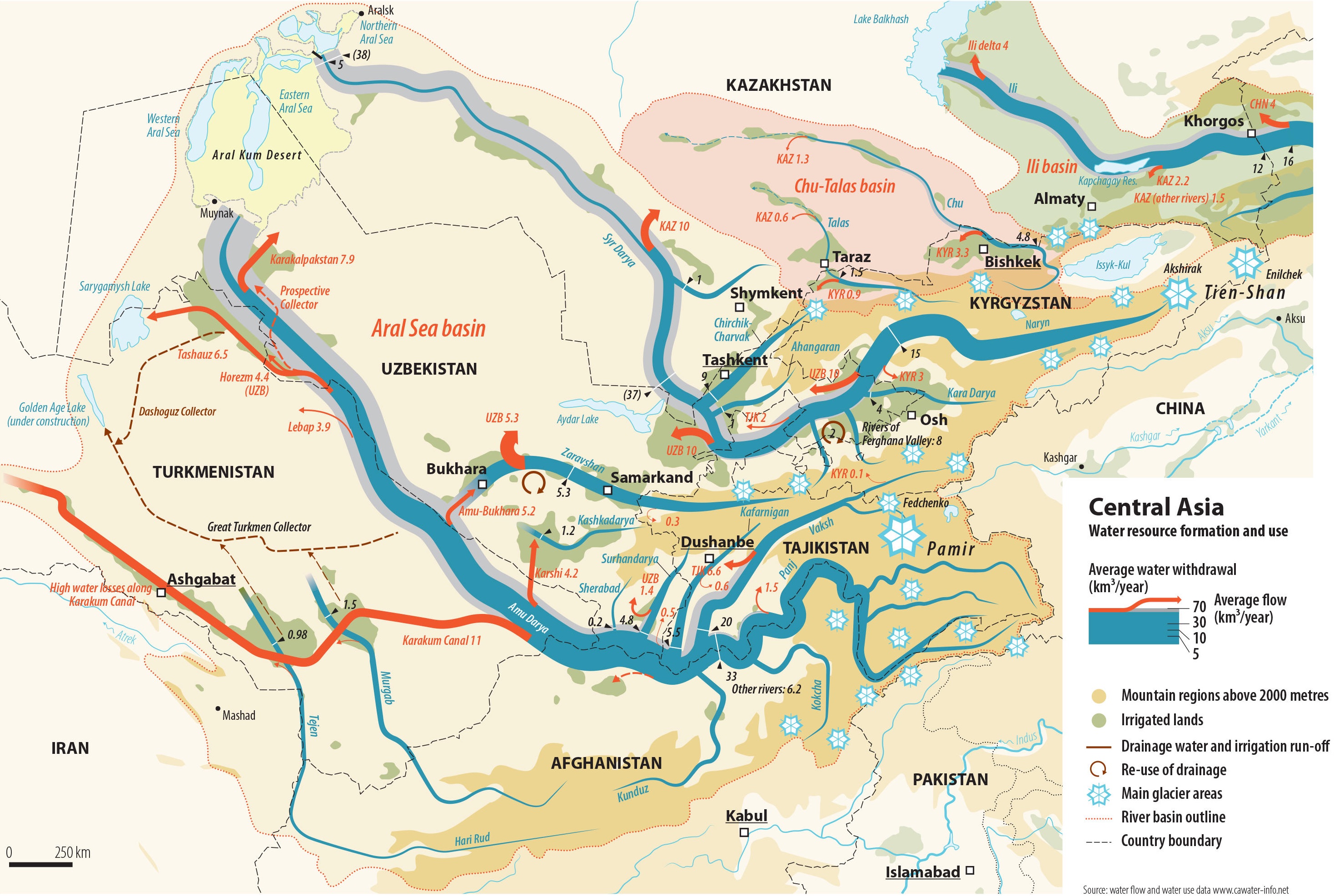
Figure 1.2: Water resources formation and use. The infographics river width is proportional to average discharge at the particular locations. The red arrows indicate water diversion from rivers into irrigation canals. The gray bands around the rivers in the downstream indicate their natural unaltered runoff. Also note the reuse of drainage water in the Syr Darya. Source: Zoï Environment Network.